


Files
Download Full Text (1.6 MB)
Description
Alexander Krest, GEG525: Fundamentals of GIS
Faculty Mentor(s): Professor Tao Tang, Geography and Planning
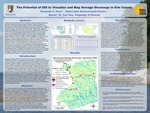
Combined sewer overflows (CSOs) and sanitary sewer overflows (SSOs) are detrimental events that at times release hundreds of millions of gallons of untreated and partially treated sewage per month into WNY waterways. These discharges pose a multi-dimensional threat, impacting local economies, regional ecology, and public health, among other things. Unfortunately, despite a couple highly publicized events, there is still a lack of attention paid to this issue. In 2013, New York State passed Assembly Bill A10585A, more commonly known as the Sewage Pollution Right to Know Act, which requires publicly owned wastewater treatment facilities to report discharges of untreated or partially treated sewage to the DEC. While this legislation is a step in the right direction, the sheer number of incidences, coupled with varied reporting strategies and messy database configuration make the prospects of working with this data quite intimidating, especially for those not accustomed to the field. Looking at sewage discharge reports for Erie County for the month of September 2019, this project aimed to gauge the potential of displaying this data through GIS applications for public, municipal, and scientific consumption. The results of this undertaking produced a map that--while relatively easily understandable when compared to the traditional Excel format in which the data is often presented--was limited in the scope of true representation of sewage discharges. However, the use of GIS certainly has the potential to aid municipalities and citizens in visualizing regional sewage discharges.
Publication Date
2021
Recommended Citation
Krest, Alexander, "The Potential of GIS to Visualize and Map Sewage Discharge Reports" (2021). Physical Geography and Sciences. 11.
https://digitalcommons.buffalostate.edu/srcc-sp21-physgeosci/11