


Files
Download Full Text (1.3 MB)
Description
Xuejing Hu, GEG 518: Remote Sensing
Faculty Mentor: Professor Tao Tang, Geography and Planning
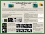
Recently, the algae blooms in western Lake Erie has aroused people’s concern, which can cause the death of marine lives, the pollution of drinking water, the decline of fishing and tourism industries, and other problems. With the growing frequency and magnitude of algae blooms, it has been becoming a public health and ecosystem hazard. In this research, remote sensing satellite images were collected through the United States Geological Survey, including the Landsat images of western Lake Erie in the summers of 1989, 1999, 2008, and 2019. Remote sensing software ERDAS IMAGINE was utilized in pre-processing the images, extracting algae bloom area, and conducting NDVI classification to study the spatial distribution and temporal variation of algae blooms. NDVI is used to assess whether the target being observed by remote sensing contains living green vegetation or not. The NDVI classification results show that the algae blooms of western Lake Erie has the regional occupations and seasonal changes. From 1989 to 2019, the lake algae spread from the west to the middle of the lake. By 2019, the area of algae has increased significantly. With the increase of summer temperature, the coastal lake algae also increased significantly. The algae are mainly clustered on the southern coast, west coast and southeastern bay of west Lake Erie, but there are no significant algae blooms on the eastern part of the west Lake Erie. The major influence factors for the algae blooms in western Lake Erie are temperature changes during recent years, human activities, and farming.
Publication Date
2020
Recommended Citation
Hu, Xuejing, "Western Lake Erie Algae Bloom Analysis Applying Satellite Remote Sensing" (2020). Physical Geography and Sciences. 22nd Annual Student Research and Creativity Conference. SUNY Buffalo State.
https://digitalcommons.buffalostate.edu/srcc-sp20-physgeosci/10