


Files
Download Full Text (3.0 MB)
Description
Elizabeth Mahoney, GEG418: Remote Sensing
Faculty Mentor(s): Professor Tao Tang, Geography and Planning
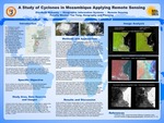
Mozambique is a poor and rapid economic developing nation on the Eastern Coast of Africa. In the spring of 2019, two massive tropical cyclones made landfall on the coast through the Mozambique Channel. The resulting devastation had catastrophic effects including massive loss of life, infrastructure, and crops, among other humanitarian crises. Using Landsat 8 satellite images obtained from US NASA that were taken before and after the two storms, I processed multiple imagery maps using ERDAS imagine software to classify the changes of land use before and after the cyclones and to access the disaster and damage to the country. Using the tools and skills in Remote Sensing, my aim is to visually represent the gravity of the crisis that affected and continues to affect Mozambique. Understanding the impacts of these storms on land use, agriculture, GDP, the loss of human life and many other factors including the HDI (United Nations Human Development Index), we can learn what outcomes can be expected as climate change causes more storms of this nature with increasing strength and frequencies. I hope that we can improve United Nations disaster relief and humanitarian aid handling and enhance direct foreign investments through this study.
Publication Date
2021
Recommended Citation
Mahoney, Elizabeth, "A Study of Cyclones in Mozambique Applying Remote Sensing" (2021). Physical Geography and Sciences. 8.
https://digitalcommons.buffalostate.edu/srcc-sp21-physgeosci/8