


Files
Download Full Text (2.2 MB)
Description
Hutong Fan, GEG 518: Remote Sensing
Faculty Mentors: Professor Tao Tang, Geography and Planning and Professor Lei Deng, Capital Normal University
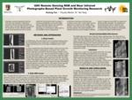
Nowadays, precision agriculture becomes more and more important in agricultural production. Remote sensing techniques are always used in precision agriculture to promote the productivity of crops. Although satellite-based remote sensing has been a popular method for monitoring the earth's surface, it has several drawbacks. With the improvement of drone technology, an unmanned air vehicle (UAV) is more flexible in terms of deployment, monitoring small areas, and cost effective on data collections. In this project, the first objective is to merge the UAV images of the vineyard. There are two kinds of images, RGB and near-infrared. For the near-infrared images which cannot be merged automatically using Pix4D photogrammetric software, Photoshop software was used to conduct the preliminary synthesis. The second objective is to combine both RGB and infrared images into different layers radiation bands of one image and to use NDVI (Normalized Difference Vegetation Index) to analyze the growth situation of grapes in the study vineyard. This research demonstrated that it is feasible to use Photoshop software to mosaic the images that cannot be merged in Pix4D. However, further studies are need for the accuracy issues of both spectral and locations. The significance of this study is 1) finding the alternative method to merge the near-infrared images, and 2) using the NDVI to analyze the growth conditions of the grapes in the study area.
Publication Date
2020
Recommended Citation
Fan, Hutong, "UAV Near Infrared Remote Sensing for Crop Growth Monitoring" (2020). Physical Geography and Sciences. 22nd Annual Student Research and Creativity Conference. SUNY Buffalo State.
https://digitalcommons.buffalostate.edu/srcc-sp20-physgeosci/4